
in2Dredging’s new service is so cutting-edge that we had to create a completely new name for it. Since most of the data used is georeferenced, we felt that a service by the name of “Geographic Data Processing” would cover it well.
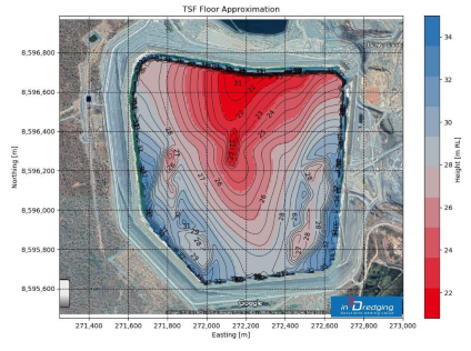
Despite technological advances, dredging professionals often face unique challenges when processing big datasets originating from several engineering fields.
These days, big data is easily acquired through site investigations and during project execution. What is not easy, is combining and processing the various large geographic datasets to create, for instance, one single map. in2Dredging have pre-invested in the development of tools that provide the required single unified view over these multifaceted datasets. i2D’s geographic data processing tools are powerful and versatile and can deliver groundbreaking insight at just one glance.
For more details, visit our new webpage.